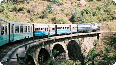
The Indian Railways system has been on an upward trend ever since 1853, when the first train moved from Bombay to thane. There was no looking back since then. The novel plan of introducing a rail system in India transformed the whole history. Ever since its origin in 1853 the rail service in India never turned back again. It went on knitting new links and adding new stations to the already existing ones. In the year the first electric locomotive engine emerged.
The Indian Railway system came under direct control of the Government immediately after the World War I. since then the Indian Railways have developed a nationwide network, touching all possible places.
 It has been a great integrating force since last 150 years. The rail system in India has a vast network covering each and every dimension in India. It covers 28 states and three Union Territories, along with it also touches some areas of Nepal, Bangladesh and Pakistan. The total route network of the Indian Railway system is not less than 63,465 km. The total length covered nears about 108,805 Km. The Himsagar express is the longest train on route running between Jammu Tawi and Kanyakumari, covering a distance of 3751 km.
The Indian Railway system has divided India into four major and twelve sub zones. The Indian Rail network is one of the largest in the world. The railway route map helps in thus finding out the wide coverage provided by the trains that run in India. Such a map is easily available in the form of a magazine easily available at bookstores and stations. Internet once again comes handy with numerous sites and the IRCTC official website providing a detailed map of the rail route in India. Thus the next time if one wants to explore those untrodden lands, a review of the rail map of India is a must.